Estimated reading time: 6–8 minutes
Key Takeaways
- Modern emergency highway planning focuses on quick access, minimizing traffic blockages, and saving lives within the crucial “Golden Hour”.
- Dedicated structures like Emergency Landing Facilities (ELFs) turn highway stretches into operational runways for defense and medical relief during crises.
- Advanced Traffic Management Systems (ATMS) utilize AI and high-definition PTZ cameras to detect and coordinate responses to accidents instantly.
- Standardized NHAI emergency protocols ensure round-the-clock patrol units and heavy-lifting cranes are strategically placed.
- Commuters can actively prevent secondary accidents by executing a systematic 5-step breakdown safety protocol.
Table of Contents
- Seconds Count: How Modern Emergency Access Highway Systems Save Lives on India’s Expressways
- Key Takeaways
- Introduction
- Section 1: Strategic Blueprint: Designing Safer Roads for the Future with Modern Emergency Planning Highway Systems
- Section 2: The NHAI Framework: Standardized Emergency Protocols NHAI and Procedures
- Section 3: Real-Time Action: On-Ground Crisis Management Highway Systems and Response
- Section 4: Commuter Safety: What to Do on an Emergency Access Highway
- Section 5: Summary: A Shared Responsibility for Emergency Response NHAI Solutions
- Frequently Asked Questions
Introduction
A modern emergency access highway is a special road designed to keep traffic moving and save lives when major accidents happen. High-speed roads help us travel quickly, but they can also be very dangerous places when crashes occur.
Fast travel makes our lives easier, but it also means accidents can be much more severe. This article will show you how smart road design and quick emergency plans protect drivers on the road.
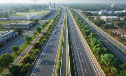
High-speed expressways and national highways are like the veins of a country. They carry cars, buses, and heavy trucks filled with goods to every city.
However, these fast roads have a major problem. When vehicles drive at high speeds, any mistake can lead to a very bad crash.
When a crash happens on a high-speed road, it can block all the lanes behind it. This creates a giant traffic jam that can stretch for many kilometers.
This traffic jam is called a bottleneck. It stops traditional rescue vehicles, like fire trucks and ambulances, from reaching the people who need help.
To solve this problem, road builders are changing how they design highways. They no longer just think about how smooth the asphalt is or how many lanes a road has.
Instead, modern highway design includes a full emergency planning highway system. This system includes special rescue zones, places for medical helicopters to land, and quick-entry paths for emergency teams.
“By planning for emergencies before building the road, we can save lives when seconds count.”
These features help rescue workers reach accidents fast, even when the highway is completely blocked. To learn more about how India is building these fast and safe roads, you can visit the Ministry of Road Transport and Highways website.
Section 1: Strategic Blueprint: Designing Safer Roads for the Future with Modern Emergency Planning Highway Systems
Building a safe highway starts with a good blueprint. Modern engineers use an emergency planning highway design to make sure roads stay open during disasters.
This means roads are built to survive extreme weather like heavy rain, floods, and earthquakes. If a major disaster happens, these highways can still be used to evacuate people and deliver food and medicine.
+-------------------------------------------------------------+
|               Modern Highway Safety Elements                |
+-------------------------------------------------------------+
|  [ Emergency Landing Strip ] -> For medical & rescue planes |
|  [ Steel Rockfall Barriers ] -> Stops rocks on mountain roads|
|  [ Box Culvert Drainage ]    -> Prevents water from pooling |
+-------------------------------------------------------------+
One of the coolest parts of modern road design is the Emergency Landing Facility, or ELF. These are special, super-strong parts of the highway that can be used as runways for airplanes.
If there is a big disaster, military transport planes and medical helicopters can land right on the highway. To make this possible, engineers build these runway sections with extra-thick concrete.
The concrete is usually 30 to 45 centimeters thick. This is much thicker than normal road pavement. This extra thickness is important because it prevents heavy cargo planes, like the C-130J Super Hercules, from cracking the road when they land.
These runways also do not have any overhead power lines, light poles, or tall trees nearby. Instead of permanent concrete walls in the middle of the road, engineers use metal barriers that can be unscrewed and rolled away in just a few minutes. This creates a wide, flat space for planes to touch down safely.
India has already built several of these emergency runways. For example, the Indian Air Force and highway workers built a successful landing strip on National Highway 925A in Rajasthan. They have also built one on the Purvanchal Expressway in Uttar Pradesh. These runways show how a road can change from a highway into a military rescue base in minutes.
Engineers also use a disaster management highway plan to deal with local weather hazards. In mountain areas, they install heavy steel nets called rockfall barriers. These nets stop giant stones from rolling onto the road and crushing cars. They also spray a special liquid concrete called shotcrete onto dirt hills to keep them from sliding down.
In flat areas that get a lot of rain, engineers build micro-drainage networks. These networks use big concrete tunnels under the road, called box culverts, to carry rainwater away quickly. This prevents water from pooling on the road. When water pools on a road, tires can lose their grip, which is a dangerous event called hydroplaning.
To read more, you can access the official news about the opening of the emergency landing strip in Rajasthan. To check out standard compliance frameworks, you can review the National Highways Authority of India website and their dedicated checklist on quality control standards.
Section 2: The NHAI Framework: Standardized Emergency Protocols NHAI and Procedures
To save lives on national highways, rescue teams must follow the exact same steps every single time. The National Highways Authority of India uses standardized emergency protocols NHAI rules across the country. These rules make sure that the private companies running the roads meet strict safety standards. If these companies do not meet their safety goals, they can face big fines.
One of the most important rules is having 24/7 Route Patrol Units. These are safety trucks that drive back and forth along assigned stretches of the highway. Each truck is responsible for a section of road that is about 45 to 50 kilometers long. These patrol trucks carry first aid boxes, neck braces, fire extinguishers, and orange traffic cones to secure crash sites.
       [Patrol Unit detects crash]
                   │
                   ▼
     [Secures area with orange cones]
                   │
                   ▼
  [Calls 10-20 Ton Towing Crane if needed]
The highway operators must also have heavy-duty towing cranes parked at regular intervals along the road. These cranes must be strong enough to lift 10 to 20 tons. This heavy lifting power is needed to quickly pull crashed semi-trucks out of the way. If a big truck blocks the road, the cranes can move it to the side to let traffic flow again.
All of these rules are designed to help during the “Golden Hour.” The Golden Hour is the very first hour after a person gets hurt. Medical doctors say that if an injured person gets professional medical treatment within this first hour, their chance of surviving goes up by 50 percent.
To help ambulances move quickly during this time, toll plazas have special lanes called emergency bypass lanes. These lanes do not have long lines of cars. They use automated sensors, like RFID and FASTag, to recognize registered ambulances and open the toll gates automatically.
Additionally, under the emergency procedures NHAI guidelines, local control rooms keep a live map of all nearby hospitals. This map shows both public and private hospital emergency rooms. When a crash happens, the control room instantly alerts the nearest hospital. This gives doctors time to get ready before the ambulance even arrives.
To read the official policies and circulars about highway safety and patrol rules, visit the dedicated circulars and advisories portal.
Section 3: Real-Time Action: On-Ground Crisis Management Highway Systems and Response
When an accident happens, highway workers must act fast. Modern roads use a digital tech system called the Advanced Traffic Management System, or ATMS. This system helps workers run a smart crisis management highway plan by monitoring traffic every second. The system uses three main tools to watch the road.
First, there are Pan-Tilt-Zoom, or PTZ, security cameras placed every 2 kilometers. These high-definition cameras can spin in circles and zoom in from far away. This lets operators in the central control room see exactly what is causing a traffic block. They can zoom in to see if a car has a flat tire or if there is a multi-car crash.
+-----------------------------------------------------------------+
|             Advanced Traffic Management System (ATMS)           |
+-----------------------------------------------------------------+
|  [ PTZ Cameras ]   -> Spin and zoom to show crash details       |
|  [ AI Video Unit ] -> Automatically spots stopped cars or debris|
|  [ Digital Signs ] -> Warns drivers to slow down before a crash |
+-----------------------------------------------------------------+
Second, the system uses an AI-powered computer tool called the Automatic Incident Detection System, or AIDS. This software watches the video feeds for things like stopped cars, people driving the wrong way, or debris on the road. If the computer sees a problem, it sounds an alarm in the control room right away. This allows operators to spot accidents without waiting for someone to call them.
Third, there are giant overhead LED signs called Variable Message Signs, or VMS. These are digital screens that hang over the highway. If there is an accident ahead, the control room can instantly change the sign to say “Accident Ahead – Reduce Speed to 40 km/h.” This warns drivers behind the crash so they can slow down, preventing secondary chain-reaction crashes.
If you ever need help on a national highway, you can dial the 1033 helpline number. This is a free emergency phone number run by the government. This number is geofenced, which means the computer automatically knows which highway tower your call is coming from. It instantly connects you to the closest highway control room.
The operator who answers your call can see the live locations of all patrol cars and ambulances on a computer screen. They will send the closest GPS-enabled ambulance to your exact location. Once the rescue team arrives, they follow a strict, three-step emergency response NHAI plan to clear the road:
- Secure the Scene: The patrol team parks their truck behind the crash and sets up reflective orange cones and flashing lights to warn oncoming cars.
- Help the Injured: Medical workers check on any hurt passengers and stabilize them before putting them into the ambulance.
- Clear the Road: Tow trucks lift the broken cars and pull them away, while workers sweep up broken glass so the highway can open again.
To read the full technical manual on how these smart traffic systems are set up on Indian expressways, you can refer to the official design documents. Additionally, you can find more details on how the 1033 national emergency helpline works online.
Section 4: Commuter Safety: What to Do on an Emergency Access Highway
While road builders and rescue teams do a lot of work, drivers also play a major role in highway safety. Your quick actions during a breakdown can prevent a second crash. If your car breaks down on an emergency access highway, you should follow these steps immediately:
+------------------------------------------------------------+
|                  Breakdown Action Plan                     |
+------------------------------------------------------------+
| 1. Pull over to the far left shoulder.                     |
| 2. Turn on your hazard lights.                             |
| 3. Put your orange warning triangle 150 meters behind car. |
| 4. Call 1033 and give your milestone number.               |
| 5. Step over the metal guardrail to wait safely.           |
+------------------------------------------------------------+
- Move to the Left Shoulder: If your car is still moving, signal and gently steer it all the way to the paved shoulder on the far-left side of the highway. Never stop near sharp turns, the top of hills, or in the middle of travel lanes.
- Activate Hazard Warning Lights: Press the red triangle button in your car to turn on all four turn signals. This makes your car flash and helps other drivers see you, especially at night or during heavy fog and rain.
- Deploy the Reflective Warning Triangle: Open your trunk and grab your orange reflective warning triangle. Walk back behind your car and place it on the ground. On fast expressways where cars drive at 120 km/h, you must place the triangle at least 150 meters behind your vehicle so oncoming drivers have enough time to react and slow down.
- Dial the 1033 National Helpline: Call the highway helpline on your phone. To help them find you, look out the window for the nearest green concrete milestone marker on the side of the road, or share your live GPS coordinates from your smartphone.
- Evacuate Behind the Crash Barriers: Never stand next to your car or sit inside it while waiting for help on the shoulder. Instead, have everyone exit the car from the passenger side, step over the metal W-beam guardrails, and wait safely on the grassy hill next to the road.
Section 5: Summary: A Shared Responsibility for Emergency Response NHAI Solutions
Keeping our fast roads safe is a job for everyone. Engineers, rescue teams, and drivers must work together to make sure that accidents do not turn into disasters.
This table shows the core life-saving features on modern roads:
| System / Protocol | Key Action & Operational Impact |
|---|---|
| Emergency Landing Facilities (ELFs) | Reinforces highway stretches to serve as airstrips for relief aircraft and military defense transport during crises. |
| Advanced Traffic Management System (ATMS) | Integrates AI-driven cameras (AIDS) and digital signage (VMS) to spot and manage collisions in real-time. |
| National 1033 Helpline | Provides a single, geofenced, 24/7 helpline to dispatch local ambulances and patrol vehicles to precise locations. |
| The Golden Hour Protocol | Leverages toll bypass lanes and coordinated trauma hospital mapping to ensure critical care within 60 minutes. |
A great highway needs both smart design and safe driving. By using high-tech tools and following standardized emergency response NHAI steps, we can make our roads much safer.
However, technology is only part of the answer. The next time you go on a road trip, make sure to save the 1033 helpline number in your phone.
Before you leave, check your car’s tire pressure, test your brakes, and make sure you have plenty of windshield washer fluid. Finally, if you ever see an ambulance with its red lights flashing on an emergency access highway, safely pull over to the side and let them pass. Your quick action could give someone the life-saving minutes they need.
Frequently Asked Questions
- What is an Emergency Landing Facility (ELF) on a highway?
An ELF is a specially engineered stretch of highway featuring extra-thick concrete (typically 30 to 45 cm) and removable median barriers. It allows military transport aircraft and emergency helicopters to land directly on the road during natural disasters or security crises when traditional runways are unavailable.
- How does the national 1033 helpline locate stranded motorists?
The 1033 emergency helpline is geofenced. When a driver calls, the cellular network automatically identifies the closest highway transmission tower, placing the caller in touch with the local expressway control room. Motorists can also assist operators by reporting the nearest physical green milestone marker or sharing their live GPS coordinates.
- What does the “Golden Hour” protocol mean for accident victims?
The Golden Hour refers to the critical sixty-minute window immediately following a traumatic injury. Receiving professional medical attention within this hour increases survival chances by 50 percent. NHAI assists this protocol by integrating dedicated toll bypass lanes and direct digital dispatching to nearby trauma facilities.